Greene County
Secluded Diverse Tract With Mountain Views & A Land Conservancy Program
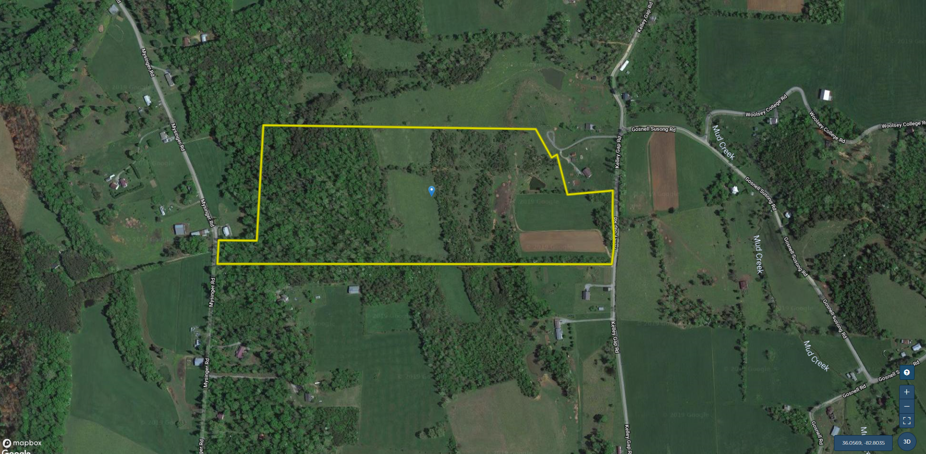
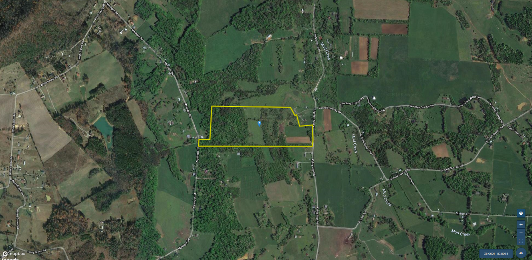
776 Kelley Gap Road Greeneville, TN 37743


Description
Natural Features
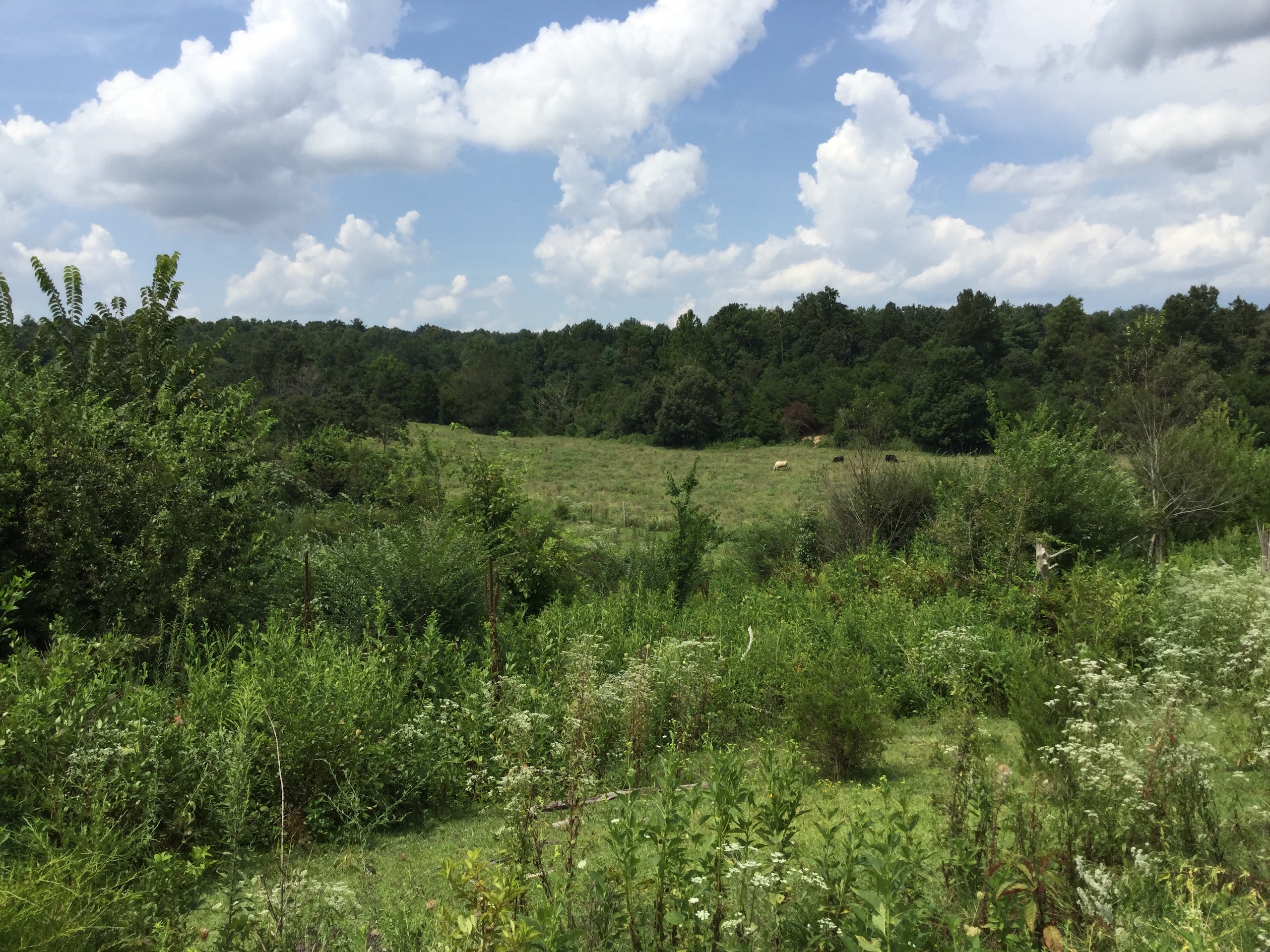
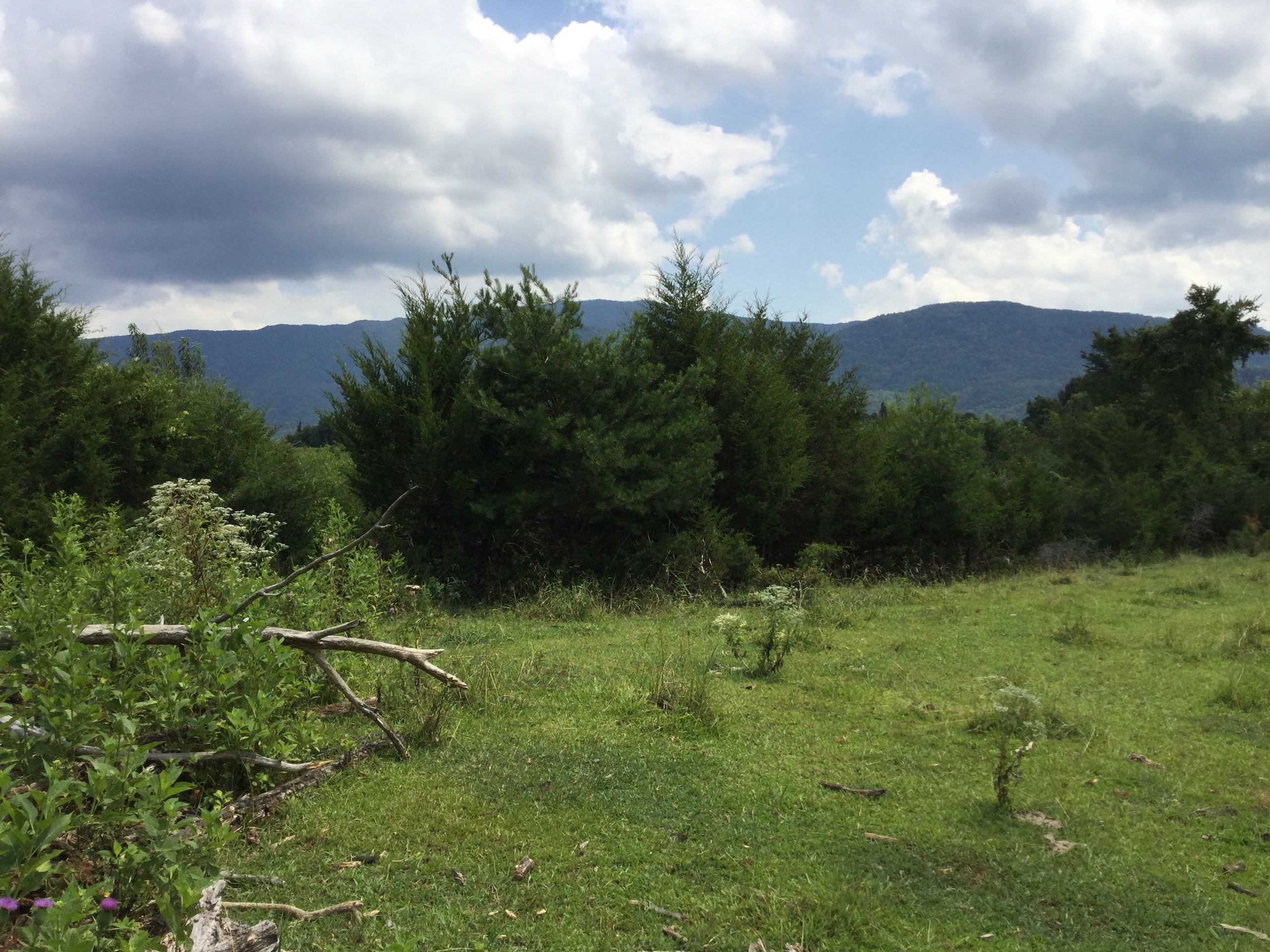
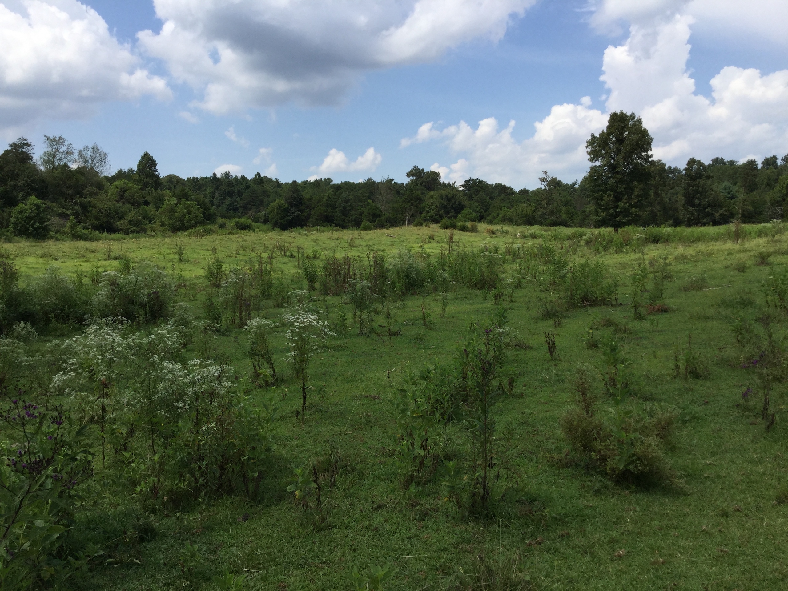
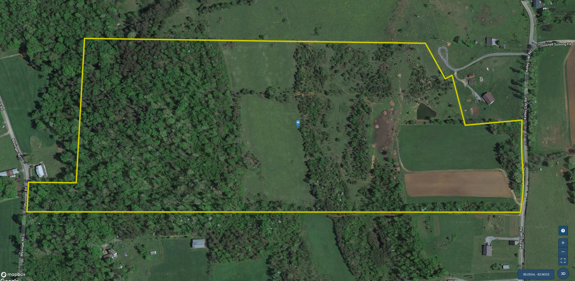
This unique farm is in a Land Conservancy Program with restrictions. The property lies in the southeastern part of Greene County, in an active farming region, and within three airline miles of the base of the Bald Mountains and the boundary of the Cherokee National Forest. Approximately half of the property is forested, one fourth is in open pasture, and one fourth is covered by scattered, large eastern red cedar trees with pasture between the trees. Soils are agriculturally suited for their present use of gazing. Perfect for cattle.
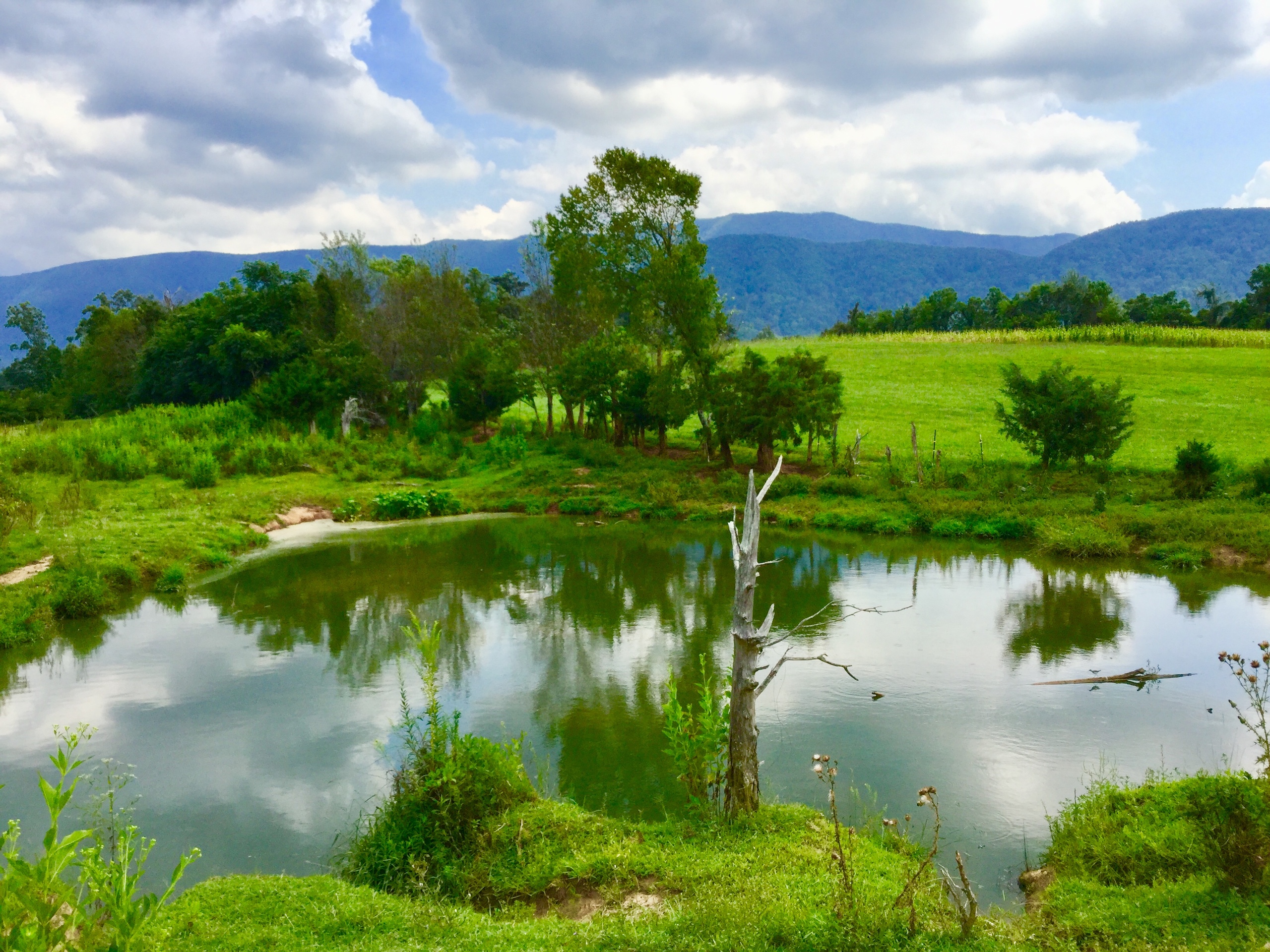
The only surface water on the property is one small man-made pond that serves the needs of the currently grazed cattle. Relief is low to moderate.
The combination of woodland, open space, and isolation with a water source makes the property attractive to a variety of native wildlife including migratory and resident birds.
This property has breathtaking views of the Bald Mountains in the Cherokee National Forest.
Land Use Information
Recent and most immediate historical usage of the property has been for grazing small numbers of livestock and for raising tobacco. The majority of the closed canopy forest consists of second growth oak/hickory with some pines. There are no forest management plans for the property at present. No clearcutting is allowed. Cutting of dead and diseased wood is permitted. The portion of the property presently in cedar woodland is to be left to natural processes and grazing.
Access to the fields and woodland is via one lane, dirt farm tracks
There is no hunting or other public access allowed on the property without the owner’s permission.
Man-made Features
A manmade pond of approximately ¼ acres is near the southern boundary of the property
The fields are fenced and cross fenced
Geology
The Knox Group (Siliceous dolomite and magnesian limestone sequence, thickness 2,500 to 3,000 ft.) underlies the entire property.
Soils
Ba Barbourville fine sandy loam
Dnd Dunmore cherty silty clay, severely eroded hilly phase
Dnh Dunmore cherty silty clay loam, eroded rolling phase
Dsd Dunmore silty clay, severely eroded hilly phase
Dsg Dunmore silty clay loam, eroded hilly phase
Dsh Dunmore silty clay loam, eroded rolling phase
Ga Greendale silt loam
Hd Hayter loam, undulating phase
Jb Jefferson loam, eroded rolling phase
Jc Jefferson loam, rolling phase
Je Jefferson stony loam, eroded hilly phase
Conservation Values
The property has a number of conservation values. Most obviously, it is a functioning farm that strives to maintain good conservation practices. There is ample open space for livestock, and there is generous forest and woodland habitat of good quality to benefit many types of wildlife.
As part of an existing scenic landscape, this farm makes an important contribution to the personality of the surroundings. For those on the property, the views of the adjacent mountains are clearly an asset.
The variety of open space and the woodland of the property provide for many of the needs of resident and migratory wildlife species to prosper year-round, and is important as a healthy part of similar adjacent habitat types in the area, adding value to the whole.
Allowing this property to remain as open space and in forest and woodland will ease development pressure in the area and will serve as an example for others of how their lands may also be protected from future development.
Policy concerning the preservation and protection of public lands is implemented in Greene and contiguous counties, Tennessee, at local, state, and federal levels.
Purpose and Summary of Easement Provisions
The purpose of this Easement is to assure that the property will be preserved forever, largely in its current state, for the benefit of the public. It is the express purpose of the Grantor to preserve the currently forested portion of the property in its natural state and to confine the use of the portion of the property currently in pasture to grazing or hay production, the portion of the property currently forested to limited forestry practices and wildlife habitat, and to preserve the open space and scenic qualities of the property.
Additional Conservation Easement information per request
Summary
Address
Features
Road Frontage
Road Surface
Fencing
Land Details
Improvements/Features
Land Type
Land and Farm Property Types
Property Type
Details
- In a Land Conservancy Program with restrictions
- Approx. 10 minutes from Highway 70
- Approx. 15 minutes to Appalachian Trail and Cherokee National Forest
- Approx. 30 minutes to Greeneville
- Approx. 50 minutes to Asheville
- Approx. 1.5 hour to Gatlinburg and Knoxville
- Approx. 1 hour to Johnson City
- Nice pond
- Rural and secluded
- Water, electricity and phone at the street
- Mountain views
Other
Utilities
Coordinates
Annual Taxes
Sold Property
For more information or to see additional properties currently for sale see David Cantrell's listings.